Port and Waterway Security
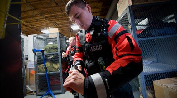
June 13, 2012 - U.S. Coast Guard
Port and Waterway Security
Along with search and rescue, port and waterway security is the Coast Guard’s primary homeland security mission. Coast Guard members protect marine resources and maritime commerce, as well as those who live, work, or recreate on the water.
Port and waterway security also involves prevention of terrorist attacks and response when terrorist acts do occur. Counter-terrorism preparedness and response operations all fall within the scope of port and waterway security.
Anti-Terrorism & Counter-Terrorism
Defeating terrorism requires an integrated, comprehensive approach that maximizes effectiveness without duplicating efforts, which is why the Coast Guard maintains law enforcement teams dedicated to fighting terrorism on our waters.
Maritime law enforcement teams serve as a tactical resource with advanced counter-terrorism skills. Teams are trained to seek out and stop potential terrorist activity before it can be initiated.
These anti-terrorism experts enforce security zones, conduct law enforcement boardings, ensure maritime security, augment shoreside security at waterfront facilities, and detect weapons of mass destruction.
PORTS AND WATERWAYS SAFETY ASSESSMENT
The risk assessment process is a disciplined approach to identify major waterway safety hazards, estimate risk levels, evaluate potential mitigation measures, and set the stage for implementation of selected measures to reduce risk. The process involves convening a select group of waterway users / stakeholders and conducting a two-day structured workshop to meet these objectives. A sponsor (e.g., Captain of the Port) is required to initiate and manage the workshop. However, the process must be a joint effort involving waterway users, stakeholders, and the agencies / entities responsible for implementing selected risk mitigation measures.
The risk assessment process represents a significant part of joint public-private sector planning for mitigating risk in waterways. When applied consistently and uniformly in a number of waterways, the process is expected to provide a basis for making best value decisions for risk mitigation investments, both on the local and national level.
PORTS AND WATERWAYS SAFETY ASSESSMENT BACKGROUND
The PAWSA process grew out of the tremendous changes that took place during the 1990s in the United States Coast Guard (USCG) Vessel Traffic Service (VTS) Acquisition program. In September 1996, Congress terminated all VTS 2000 contracts and, through the 1997 Appropriations Bill, directed the Coast Guard “to identify minimum user requirements for new VTS systems in consultation with local officials, waterways users and port authorities” and also to review private / public partnership opportunities in VTS operations. As a result of this Congressional direction, the USCG established the Ports and Waterways Safety System (PAWSS) to address waterway user needs and place a greater emphasis on partnerships with industry to reduce risk in the marine environment.
As part of PAWSS, the USCG immediately convened a national dialogue group (NDG) comprised of maritime and waterway community stakeholders to identify the needs of waterway users with respect to Vessel Traffic Management (VTM) and VTS systems. Those stakeholders, representing all major sectors of the U.S. and foreign-flag maritime industry, port authorities, pilots, the environmental community, and the USCG, were tasked to (1) identify the information needs of waterway users to ensure safe passage; (2) assist in establishing a process to identify candidate waterways for VTM improvements and VTS installations; and (3) identify the basic elements of a VTS. The NDG was intended to provide the foundation for the development of an approach to VTM that would meet the shared government, industry, and public objective of ensuring the safety of vessel traffic in U.S. ports and waterways, in a technologically sound and cost effective way.
From the NDG came the development of the PAWSA process, which was established to open a dialogue with waterway users and stakeholders to identify needed VTM improvements and to determine candidate VTS waterways. PAWSA provides a formal structure for identifying risk factors and evaluating potential mitigation measures through expert inputs. The process requires the participation of professional waterway users with local expertise in navigation, waterway conditions, and port safety. In addition, stakeholders are included in the process to ensure that important environmental, public safety, and economic consequences are given appropriate attention as risk interventions are selected.
Over 44 ports / waterways have completed the PAWSA process, which generally has been well received by local maritime communities and has resulted in some resounding successes. The ultimate goal of PAWSA is not only to establish a baseline of waterways for VTS consideration, but to provide the local host and waterway community with an effective tool to evaluate risk and work toward long term solutions tailored to local circumstances. The goal is to find solutions that are both cost effective and meet the needs of waterway users and stakeholders.
The following is a sample of experts and stakeholders that have participated in the PAWSA sessions.
- Vessel officers or operators,
- Pilots,
- Tug officers
- Ferry operators or operators of other small passenger vessels
- A spokesperson for recreational vessel operators
- A spokesperson for the commercial fishing of fishing charter industry
- Terminal operators;
- Port authorities, harbor police, and firefighters;
- Subject matter experts from environmental interest organizations;
- Municipal, county, state, and federal officials or their agency employees having waterways management responsibilities;
- USACOE project planners;
- U.S. Navy afloat community representative
- Coast Guard buoy tender or other afloat unit commanding officers; and
- Shareholders who provide the funds for the port's utility and transportation infrastructure.
PORTS AND WATERWAYS SAFETY ASSESSMENT METHODOLOGY
The PAWSA methodology developed by the USCG uses a generic model of waterway risks. That model was developed from the work done by the NDG in 1998. Risk factors identified by the NDG were put into model form by Dr. Jack Harrold of George Washington University and Dr. Jason Merrick of Virginia Commonwealth University. During the course of more than four years of PAWSA workshops throughout the United States, the model has been substantially revised to more accurately reflect the nature of waterway risks being experienced. Those revisions were made by Mr. Douglas Perkins, Program Manager and Senior Facilitator at Potomac Management Group, Inc., in consultation with the USCG Headquarters Office of Vessel Traffic Management. The only “safety” related issues that have been deliberately excluded from the model are those that relate to port, facility, and vessel security. Those security-related issues are not covered during a PAWSA because the workshop is unclassified and usually open to the public whereas discussions of security issues quickly delve into sensitive topics that should be treated as classified information. Also, the USCG conducted a separate series of Port Vulnerability / Security Assessments that looked specifically at security issues.
Methodology Explanation
Recognizing the need for a formal risk assessment for one or more waterways under his/her cognizance, a sponsor decides to hold a PAWSA workshop. Using this Implementation Guide as the primary reference, the sponsor arranges for a meeting location and selects a group of waterway users and stakeholders from the local community to participate in the workshop. During the workshop, participants discuss safety-related issues relating to the waterway and then provide numerical inputs to quantify those discussions. Those quantitative assessments are organized into five logical segments, referred to as “books.” An overview of each book is provided later in this chapter. As each book is completed, the responses are entered into the PAWSA computer software and, except for Book 1, aggregated results are then presented to the participants. Participants have the opportunity to review the results, discuss them with each other, and revise team answers if there is a MAJOR disconnect between the qualitative discussion and the quantitative output. Except for Books 1 and 2, participants use the results from each preceding book as the springboard for discussions during the subsequent phase of the process.
Waterway Risk Model
Since risk is defined as the product of the probability of a casualty and its consequences, the Waterway Risk Model includes variables dealing with both the causes of waterway casualties and their effects. The six risk categories determined were:
1. Vessel Conditions - the quality of vessels and their crews that operate on a waterway.
2. Traffic Conditions - the number of vessels that use a waterway and their interactions.
3. Navigational Conditions - the environmental conditions that vessels must deal with in a waterway relating to wind, currents, and weather.
4. Waterway Conditions - the physical properties of the waterway that affect how easy it is to maneuver a vessel.
5. Immediate Consequences - the immediate impacts of a waterway casualty: people can be injured or killed, petroleum and hazardous materials can be spilled and require response resources, and the marine transportation system can be disrupted.
6. Subsequent Consequences - the subsequent effects of waterway casualties that are felt hours, days, months, and even years afterwards, such as shoreside facility shut-downs, loss of employment, destruction of fishing areas, decrease or extinction of species, degradation of subsistence living uses, and contamination of drinking or cooling water supplies.
The diagram below shows the final form of the six risk categories and corresponding risk factors in the Waterway Risk Model.
Quantitative Assessments
Book 1: Team Expertise is used to capture the expertise of each team relative to the other teams in the workshop. The results from Book 1 are used to weight each team’s inputs for all other books.
Book 2: Risk Factor Rating Scales develops measurement scales for each risk factor by asking participants to compare specified qualitative descriptions to each other in a pair-wise manner. Those qualitative descriptions characterize the range of possible conditions that affect risk in a waterway for that factor.
Book 3: Baseline Risk Levels is used by the participants to determine where their waterway falls on the risk scales developed in Book 2. What results is the risk level for each factor, not taking into account any actions already implemented to reduce risk in the waterway.
Book 4: Mitigation effectiveness (present risk levels) is used for two purposes. After the participants describe the risk mitigation strategies that already exist to help reduce the risk level for their waterway, Book 4 is used to evaluate the effectiveness of those strategies in reducing the risk level for each factor in the model. What results from that evaluation is the present risk level, taking into account those existing mitigations. Second, they decide whether the risk mitigation strategies already in place adequately balance the resulting risk level…or not. If, for any given risk factor, there is strong consensus among the participants that existing mitigations DO adequately deal with those risks, then that risk factor is dropped from further discussion.
Book 5: Additional Intervention provides the participants an opportunity to offer ideas about specific risk mitigation actions that should be taken and to estimate how effective those actions would be in further reducing risk levels. Participants first discuss what else should be done ONLY for those risk factors where the Book 4 results show that risk levels are NOT adequately balanced with existing mitigations. Following the discussion, participants decide which ideas have the most promise for each risk factor that was discussed and what mitigation category the ideas relate to. They write a short description of the action needed, that is, the idea with the most promise, and then evaluate how much risk reduction would result if that idea was implemented.
For more information, visit: